You are here: City posts —>
The boundary marks today —>
Individual boundary marks —>
Post 156a
- Status:
Missing
- Type:
2
- National grid reference:
TQ2475956574
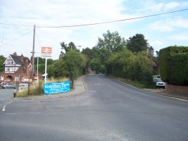
- Location:
S side of Waterhouse Lane just W of where road now crosses the railway
- Location map at Streetmap:
TQ2475956574
- Original 19th century parish:
Banstead
- Depicted on first edition of OS 6" map as:
City Post
- Moved:
No
- Circumstances of move:
n/a
- New national grid reference:
n/a
- New location:
n/a
- Map of new location at Streetmap:
n/a
- Locality:
Kingswood
- Access:
None
- Listed building:
Not listed
- Local authority:
Reigate and Banstead
- Last seen:
- Date missing:
By 1964
- Notes:
Presumably disappeared in 1897 when the railway was built
<— Previous mark |
Back up to Individual boundary marks |
Next mark —>
Page created by Martin Nail: Contact me. Last revised
24th July 2010
 This
web site: Copyright © 2010 Martin Nail. It is licensed under a Creative Commons
Attribution-Non-Commercial-Share Alike 2.0 UK: England & Wales License.
This
web site: Copyright © 2010 Martin Nail. It is licensed under a Creative Commons
Attribution-Non-Commercial-Share Alike 2.0 UK: England & Wales License.
 |
|
 |
|