You are here: City posts —>
The boundary marks today —>
Individual boundary marks —>
Obelisk 165
- Status:
Missing
- Type:
4
- National grid reference:
TQ2889656727
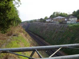
- Location:
W side of Redhill railway line, 100 m S of Star Bridge
- Location map at Streetmap:
TQ2889656727
- Original 19th century parish:
Cousldon
- Depicted on first edition of OS 6" map as:
[not marked]
- Moved:
No
- Circumstances of move:
n/a
- New national grid reference:
n/a
- New location:
n/a
- Map of new location at Streetmap:
n/a
- Locality:
Hooley
- Access:
None
- Listed building:
Not listed
- Local authority:
Reigate and Banstead
- Last seen:
1965
- Date missing:
by 1973
- Notes:
Reported in 1973 as 'taken down'. According to BR damaged in a landslip and removed. Was probably actually missing when "The coal duties of the City of London and their boundary marks" was published in 1972.
<— Previous mark |
Back up to Individual boundary marks |
Next mark —>
Page created by Martin Nail: Contact me. Last revised
24th January 2010
 This
web site: Copyright © 2010 Martin Nail. It is licensed under a Creative Commons
Attribution-Non-Commercial-Share Alike 2.0 UK: England & Wales License.
This
web site: Copyright © 2010 Martin Nail. It is licensed under a Creative Commons
Attribution-Non-Commercial-Share Alike 2.0 UK: England & Wales License.
 |
|
 |
|